
GIS Mapping
Geographic Information Systems (GIS)
The ESRI Website provides the best defintions & descriptions of what GIS is and the power of what it can provide for Ayer's residents, neighborhoods, businesses, commercial property-owners, developers, builders, corporate site locators, new companies, and all those involved in making important decisions about investing, locating, improving, and understanding the place that is Ayer, Massachusetts. Source
The Power of Mapping
- A geographic information system (GIS) lets us visualize, question, analyze, and interpret data to understand relationships, patterns, and trends.
- GIS benefits organizations of all sizes and in almost every industry. There is a growing interest in and awareness of the economic and strategic value of GIS.
Understand the World around You
- GIS software is designed to capture, manage, analyze, and display all forms of geographically referenced information.
- GIS allows us to view, understand, question, interpret, and visualize our world in ways that reveal relationships, patterns, and trends in the form of maps, globes, reports, and charts.
- GIS software helps you answer questions and solve problems by looking at your data in a way that is quickly understood and easily shared—on a map!
How Does GIS Work?
A simple five-step process lets you apply GIS to any business or organizational problem that requires a geographic decision.
- Ask: What is the problem you are trying to solve or analyze, and where is it located? Framing the question will help you decide what to analyze and how to present the results to your audience.
- Acquire: Next you need to find the data needed to complete your project. The type of data and the geographic scope of your project will help direct your methods of collecting data and conducting the analysis.
- Examine: You will only know for certain that your data is appropriate for your study after thoroughly examining it. This includes how the data is organized, how accurate it is, and where the data came from.
- Analyze: Geographic analysis is the core strength of GIS. Depending on your project, there are many different analysis methods to choose from. GIS modeling tools make it relatively easy to make these changes and create new output
- Act: The results of your analysis can be shared through reports, maps, tables, and charts and delivered in printed format or digitally over a network or on the web. You need to decide on the best means for presenting your analysis, and GIS makes it easy to tailor the results for different audiences.
The Ayer Office of Community & Economic Development partners on GIS-based tools and resources on the national, state, regional & local level.
- National: ESRI (Environmental Systems Research Institute)
- State: MassGIS
- State: Executive Office of Technology Services & Security (EOTSS)
- Regional: Montachusett Regional Planning Commission GIS Dept., GIS/IT Dir. - Jason Stanton GISP
- Local: Ayer Dept. of Public Works: Utility GIS Infrastructure Mapping & Management System
- Local: Ayer Assessors Office
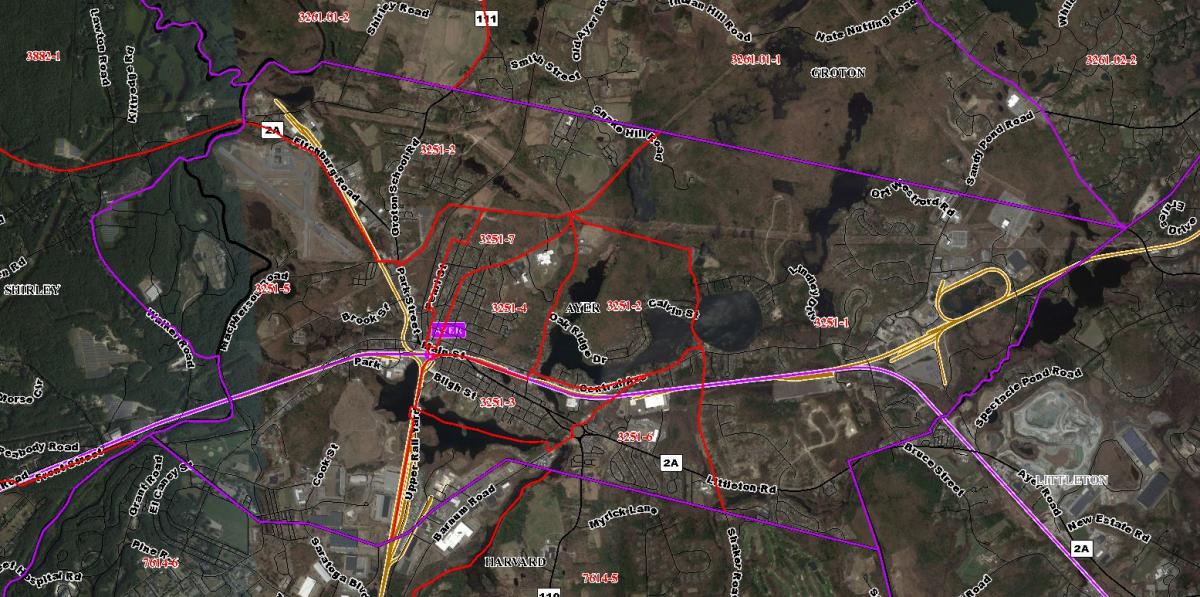
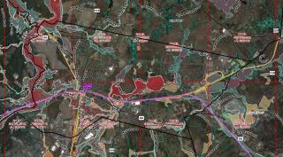
Above: MRPC GIS Map (Ayer Census Tract & Block)
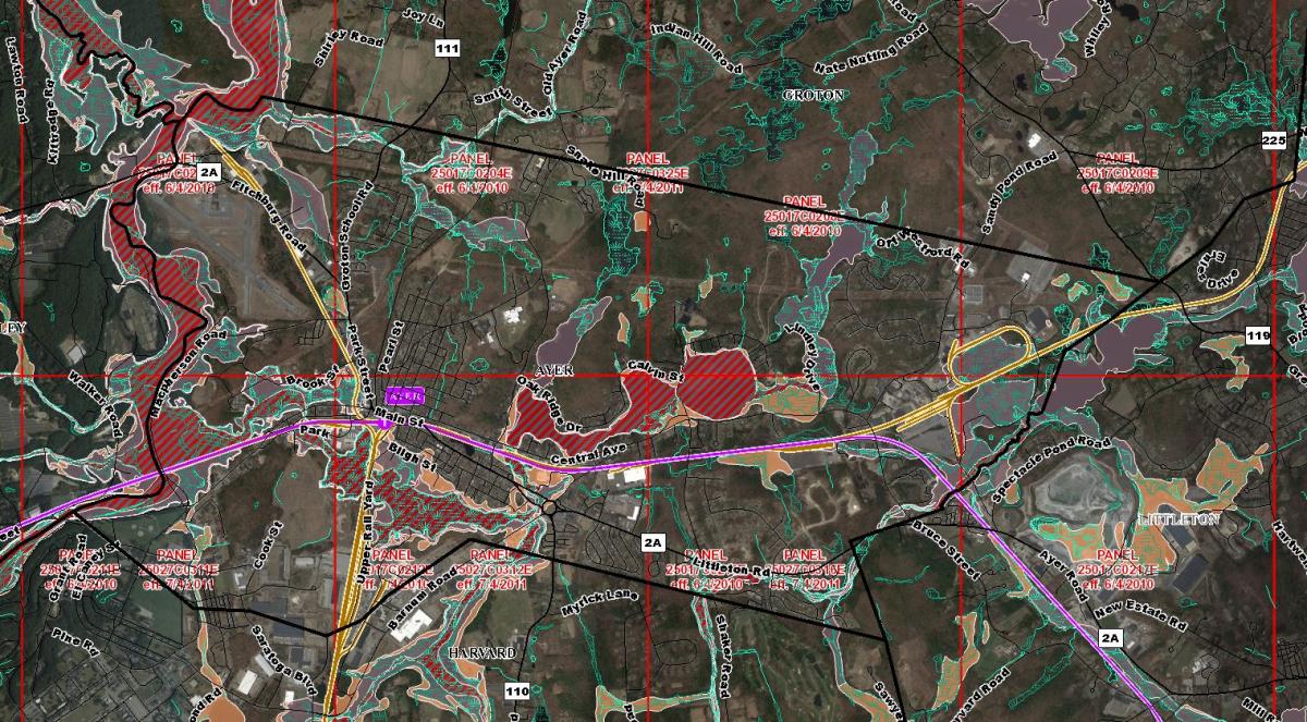
Above: MRPC GIS Map (Ayer Flood Zones & Wetlands)
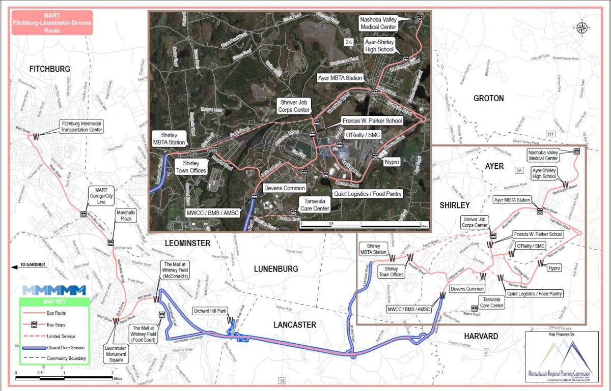
Above: MRPC GIS Map (Devens Regional Shuttle Service)